Ice Rescue Location via the USNG
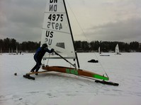
Imagine during a heavy fog/snowstorm/rainstorm that rolls in while you are sailing, you mistakenly sail your iceboat into open water. You manage to crawl out but suffered a couple cracked ribs and a broken leg.
You know what lake you are on but how can you accurately describe where you are located to the 911 emergency responders? You need a UNIQUE location identifier which is vital in any emergency situation.
Your GPS equipped cell phone has latitude and longitude but this is where the communication problems start. You location could be either:
Degrees, Minutes, Seconds: 45 00' 00"N, 95 00' 00"W
or
Decimal Degrees: 45.0000N, 95.0000W
or
Decimal Minutes: 45 00.00'N, 95 00.00'W
Try communicating this confusion to a 911 operator while hypothermia sets in.
A BETTER approach is to load this app on your cell phone:
usngapp.org
and you would see this code for your location:
15T UK 4238 8489
which describes to the nearest meter of where you are on the earth EXACTLY! This is based on the Military Grid Reference System which has been around for decades.
To learn more, go to:
usngcenter.org
Additional USNG Resources:
usngmarker.org
Order your own sign for your own trails and hunting spots.
usngstore.com
Emergency Location Markers, and even USNG t-shirts
